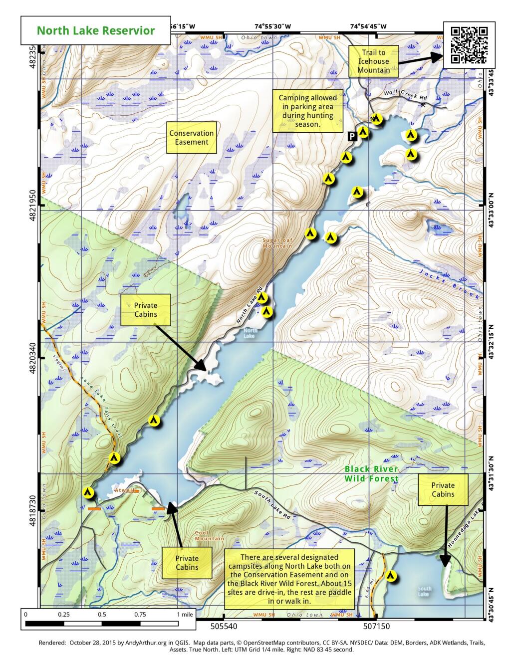
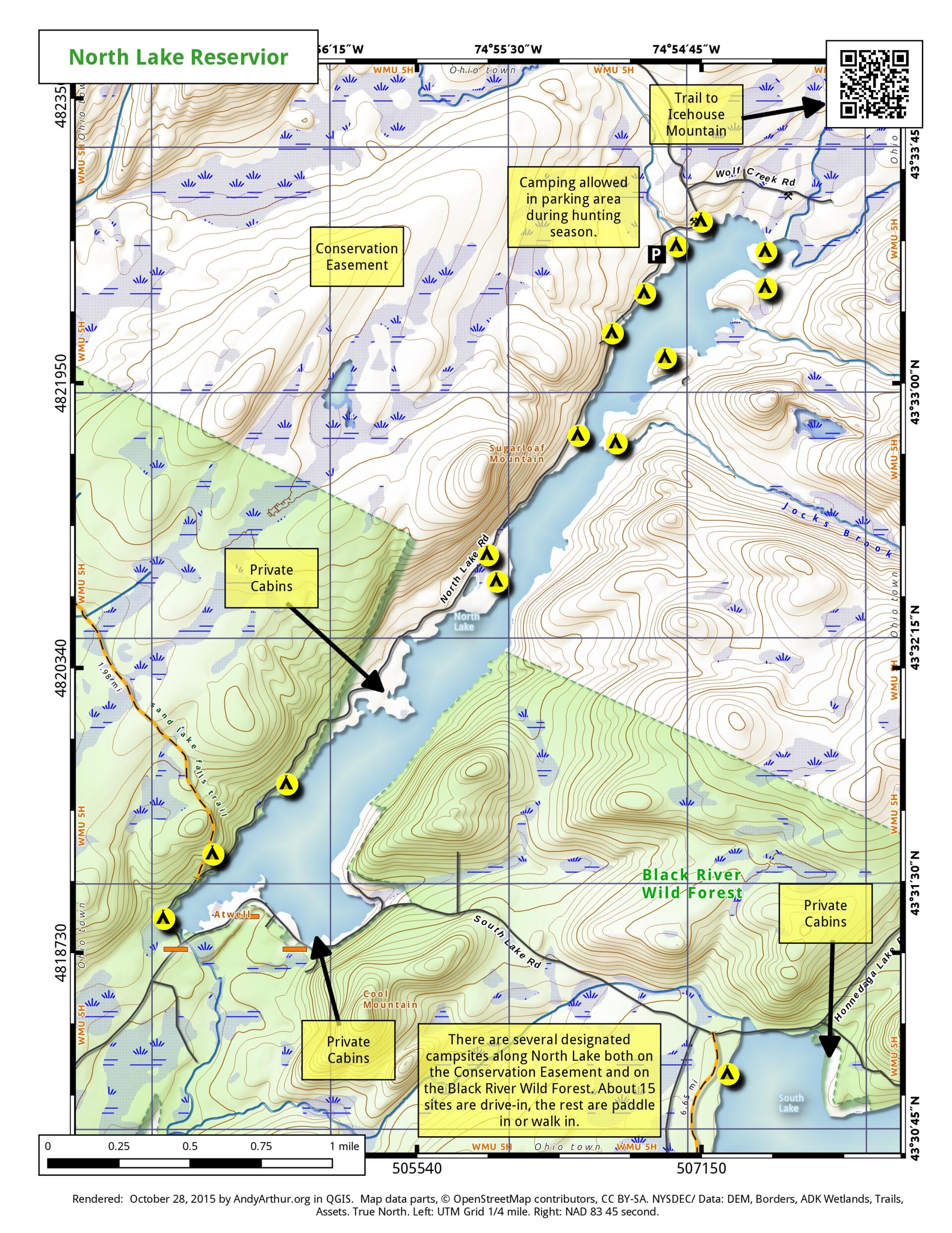
North Lake Reservior
Download a High Resolution JPEG Image of the North Lake Reservior or an Adobe Acrobat Printable PDF of the North Lake Reservior.
About Map: North Lake Reservior ....
There are several designated campsites along North Lake both on the Conservation Easement and on the Black River Wild Forest. About 15 sites are drive-in, the rest are paddle-in or walk-in.

Bookmark my free Interactive GPS Map for your phone:
https://andyarthur.org/ny
... shows your location as a blue dot in relationship to campsites, trails, state land. This online map requires cell service, won't work in remote country, so also bring a paper map.
Free Download of New & Historical USGS 1:24k Topograpic Maps
Interactive maps with backcountry and roadside camping: New York, Pennsylvania, West Virginia & Vermont. List of NYS DEC Lean-Tos and Firetowers.
Google Spreadsheet with Roadside, Primitive and Pay Campsites
More about North Lake Reservoir...
North Lake Reservoir is located at the headwaters of the Black River, and provides a steady supply of water to the Black River and Erie Canal throughout the summer. There are 25 campsites along the North Lake Reservoir, which about half of them having drive-in accessibility.


No Comments
You’re missing quite a few campsites. There are over 20, plus a lean-to
I am not surprised that I am missing several campsites … I did this based on memory, as the DEC doesn’t have most of them in their dataset.