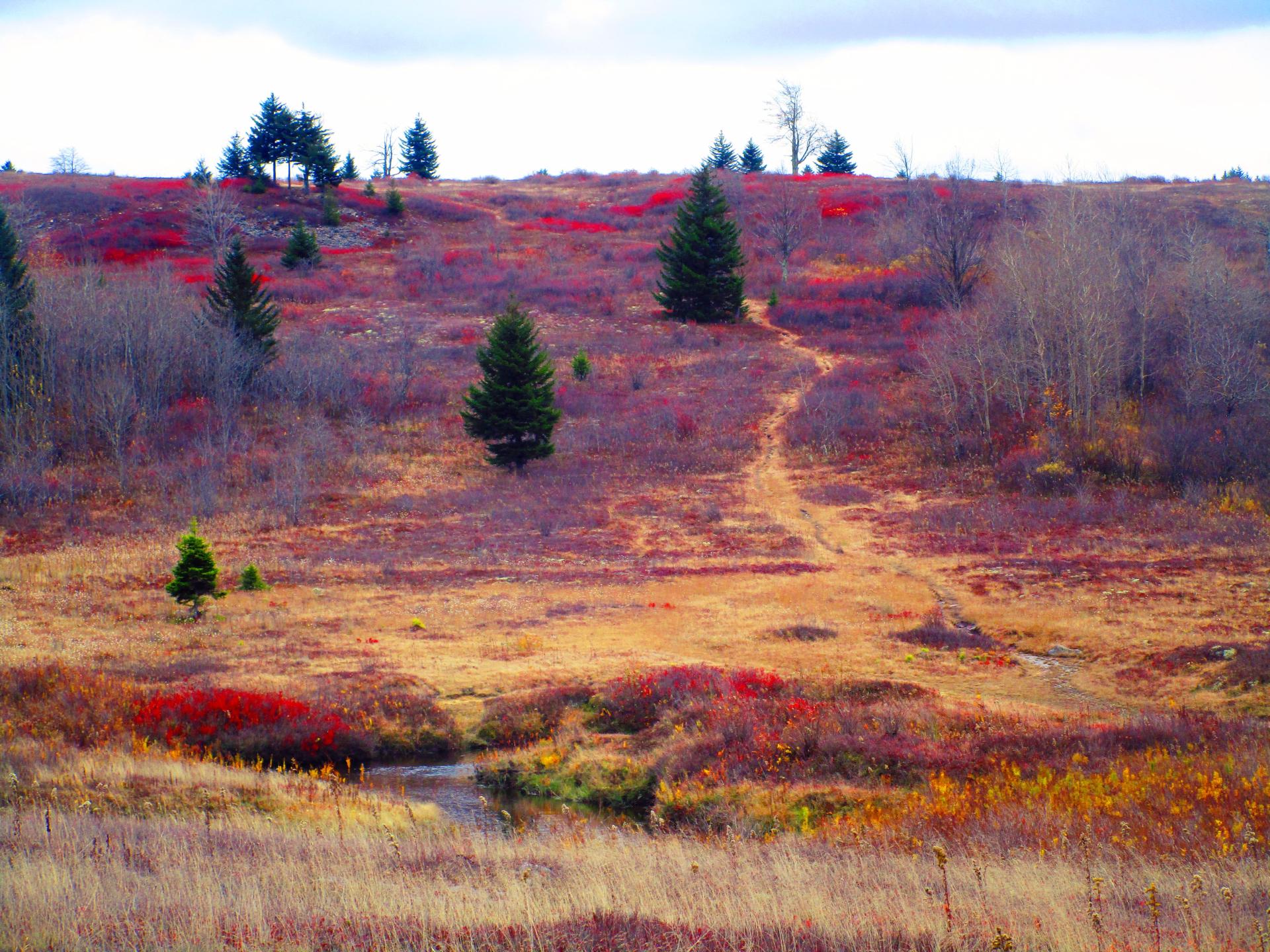
Beyond Red Creek to the Heath Barrens 🖼️
Download a High Resolution JPEG Image of the Beyond Red Creek to the Heath Barrens or an Adobe Acrobat Printable PDF of the Beyond Red Creek to the Heath Barrens.
Beyond Red Creek to the Heath Barrens ...
Looking across the Red Creek to Alder Run Trail which was impassable without getting quite wet due to high water levels in the Red Creek. While many of the colors were faded, there was still some nice color in the heath, it's bright red color emblematic of the Dolly Sods in the highest locations along the Allegheny Front.
Taken on Friday October 27, 2023 at Dolly Sods Wilderness.

More about Dolly Sods Wilderness...
The 17,371 acre Dolly Sods Wilderness in the Monongahela National Forest is part of the National Wilderness Preservation System. It is located in Grant, Randolph, and Tucker Counties, West Virginia. The Dolly Sods Wilderness contains much of the Red Creek drainage and contains bog and heath eco-types, more commonly typical to southern Canada. Elevations range from 2,500 to over 4,700 feet. https://www.fs.usda.gov/recarea/mnf/recarea/?recid=12366


