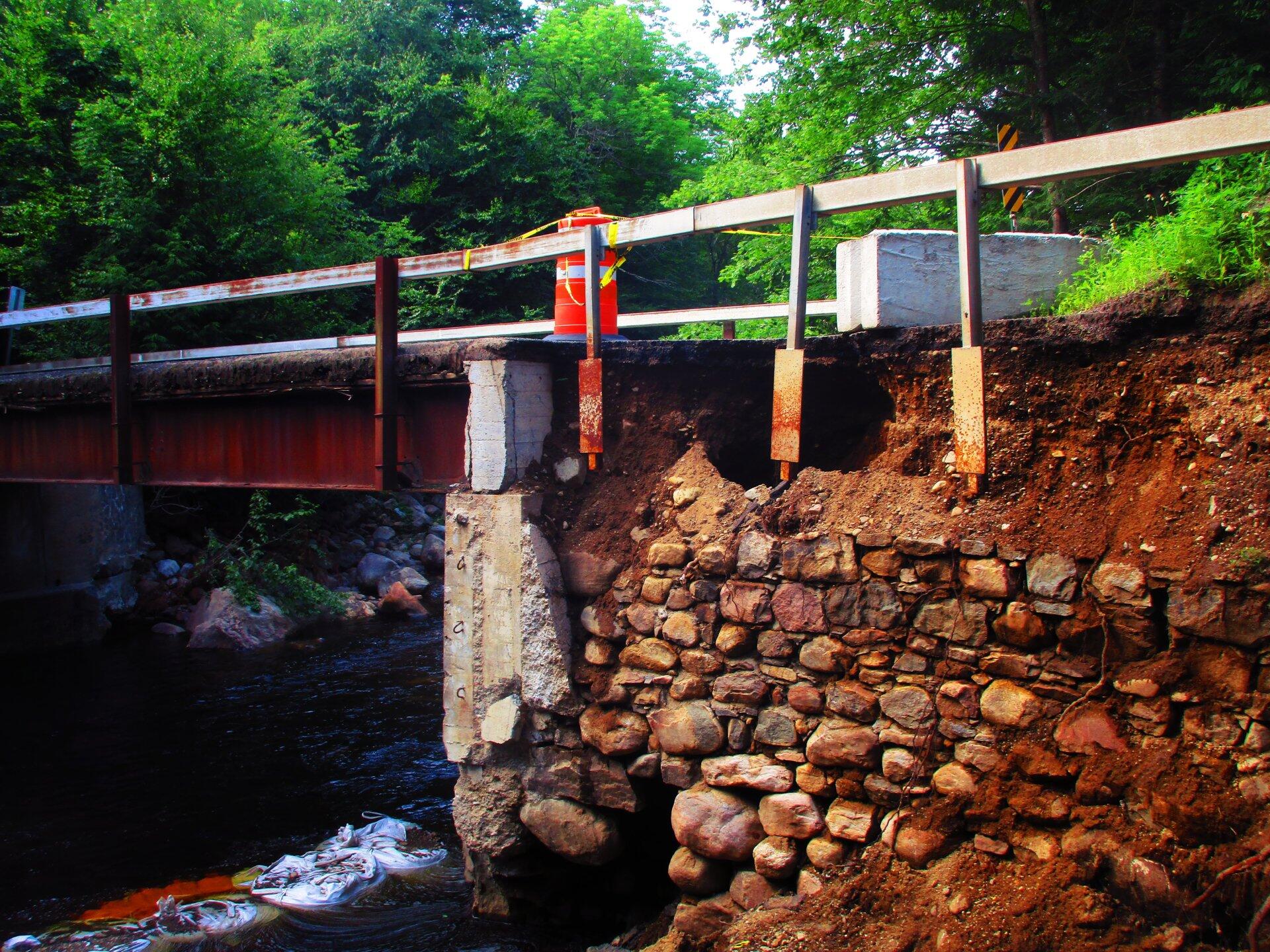
Damaged Wing Wall On Lower Piseco-Powley Road Bridge 🖼️
Download a High Resolution JPEG Image of the Damaged Wing Wall On Lower Piseco-Powley Road Bridge or an Adobe Acrobat Printable PDF of the Damaged Wing Wall On Lower Piseco-Powley Road Bridge.
Damaged Wing Wall On Lower Piseco-Powley Road Bridge ...
The washed away wing wall means that lower Piseco Road bridge is currently impassable. This is supposed to be repaired by the autumn and then the road re-graded.
Taken on Saturday July 18, 2020 at Piseco-Powley Road.

More about Piseco-Powley Road...
The 17-mile Piseco-Powley Road is a remote dirt route cutting through the Adirondack's Ferris Lake Wild Forest. It features 22 primitive roadside campsites, including four spots at Powley Place where the road crosses the West Branch of the East Canada Creek.
Download the PDF Map Pack with All Maps from Piseco-Powley Road.


")


![Photo: Above the Potholers [Expires July 23 2026]](/data/photo_24934_small.jpg "Photo: Above the Potholers [Expires July 23 2026]")


