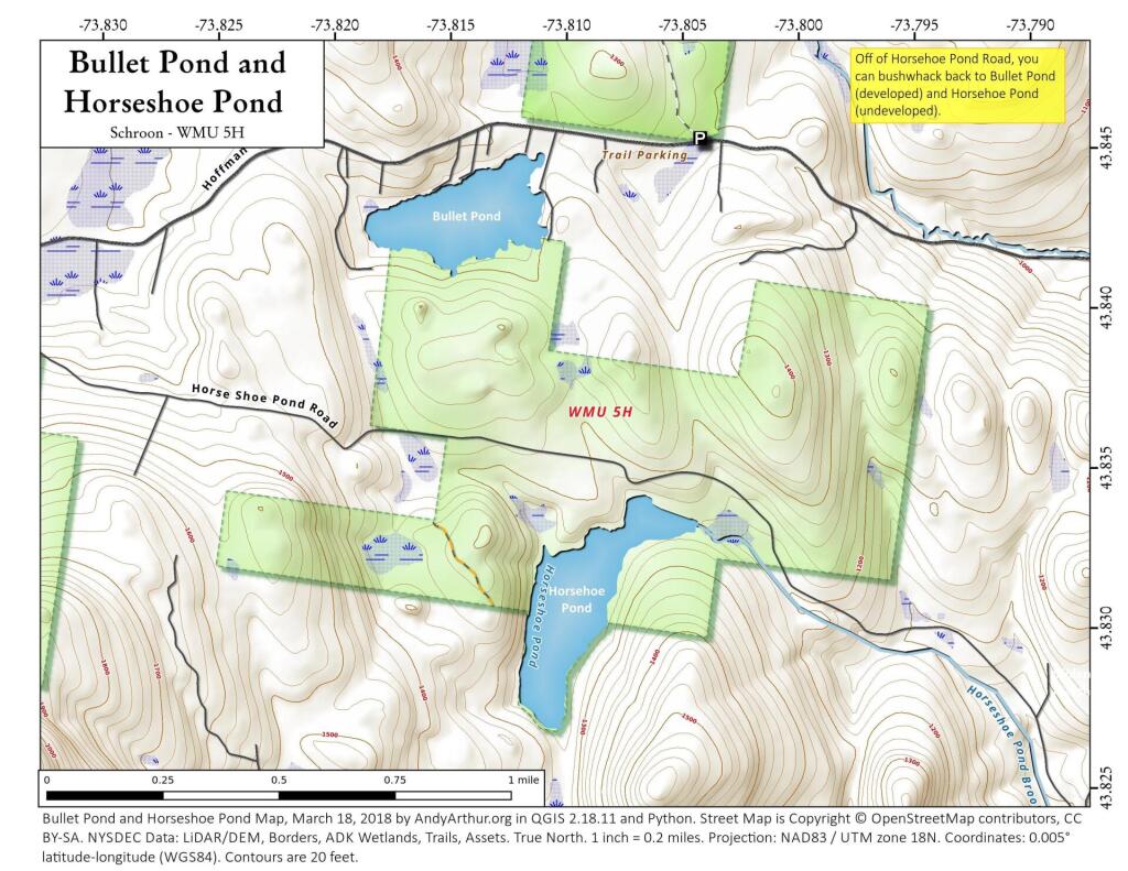
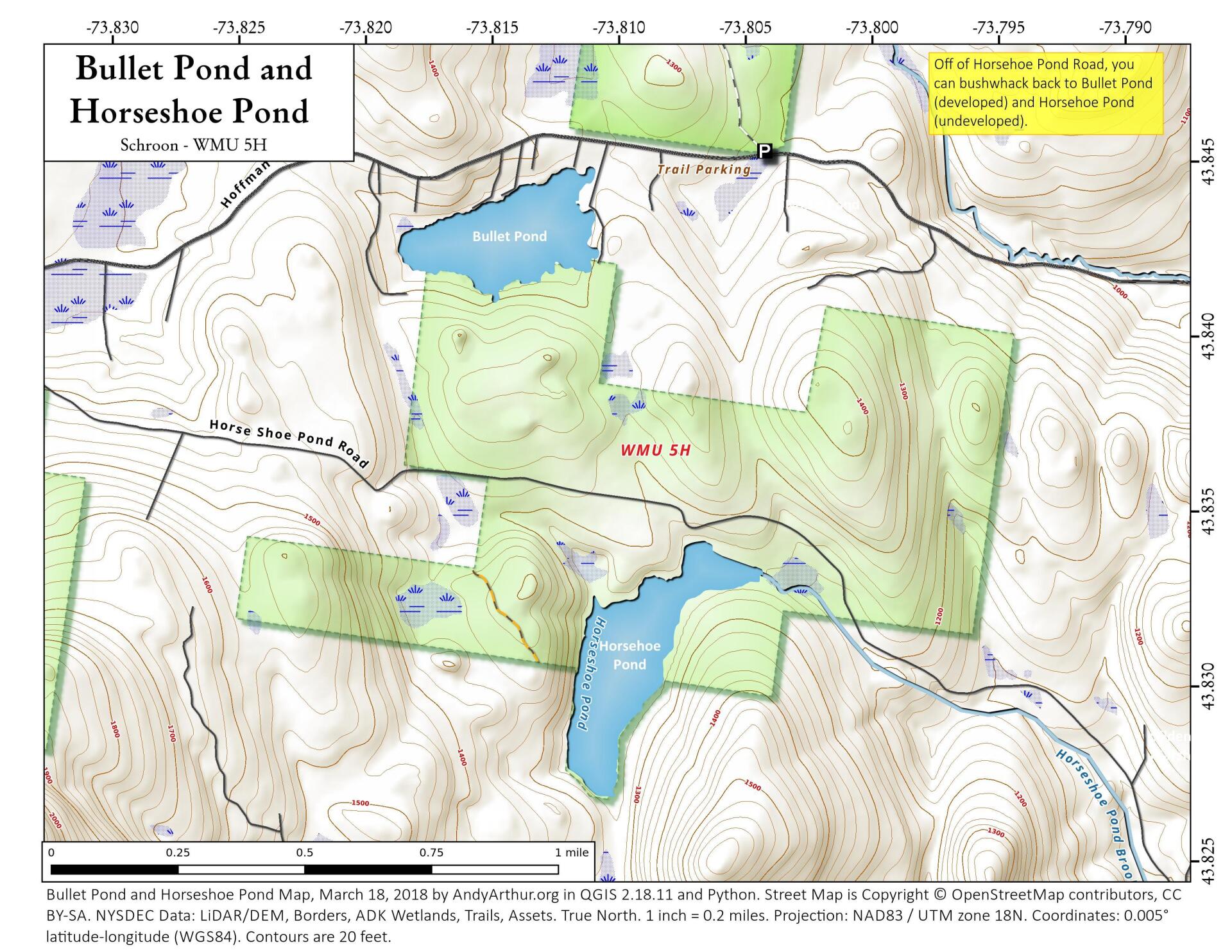
Bullet Pond And Horseshoe Pond
Download a High Resolution JPEG Image of the Bullet Pond And Horseshoe Pond or an Adobe Acrobat Printable PDF of the Bullet Pond And Horseshoe Pond.
About Map: Bullet Pond And Horseshoe Pond ....
Access to Horseshoe and Bullet Pond is via Horseshoe Pond Road which runs parallel to and intersects Hoffman Notch Road in Schroon. Bullet Pond is only accessible by a bushwhack through wilderness, it's the more developed pond, while Horseshoe Pond is much closer to the road and much more wild.

Bookmark my free Interactive GPS Map for your phone:
https://andyarthur.org/ny
... shows your location as a blue dot in relationship to campsites, trails, state land. This online map requires cell service, won't work in remote country, so also bring a paper map.
Free Download of New & Historical USGS 1:24k Topograpic Maps
Interactive maps with backcountry and roadside camping: New York, Pennsylvania, West Virginia & Vermont. List of NYS DEC Lean-Tos and Firetowers.
Google Spreadsheet with Roadside, Primitive and Pay Campsites
More about Vanderwhacker Mountain Wild Forest...
Vanderwhacker Mountain Wild Forest is a 91,854-acre public preserve in New York’s Adirondack Park. The diverse terrain features quiet lakes, vast wetlands, and rugged peaks. The highlight is the 3,386-foot Vanderwhacker Mountain, which features a restored fire tower offering panoramic views of the High Peaks. Visitors enjoy primitive camping, backcountry hiking, paddling, and snowmobiling. It provides a peaceful, less-crowded wilderness experience for outdoor enthusiasts seeking rugged Adirondack beauty.
Download the PDF Map Pack with All Maps from Vanderwhacker Mountain Wild Forest.


