Ferris Lake Wild Forest 📍

Encompassing a vast expanse of 147,454 acres, the Ferris Lake Wild Forest is characterized by the presence of ancient spruce stands. These can be observed along the Powley-Piseco Road, the northern banks of Alderbed Stream, the vicinity of Blind Man’s Vly, and the slopes of both Big and Little Alderbed Mountains. Adding to its allure, the region boasts an array of ponds, lakes, and streams, attracting outdoor enthusiasts and sportsmen year-round.

The Wild Forest accommodates 14.6 miles of hiking trails, along with an extensive 117-mile network of snowmobile trails (many of which are multi-use), catering to various recreational preferences. With 97 primitive campsites, a boat launch, and a boat dock, the area is well-equipped for adventurers. Furthermore, the public can access 10.95 miles of roads, granting motorized entry to this expansive and captivating property.

https://www.dec.ny.gov/lands/114279.html

Download the PDF Map Pack
🗺️ Maps 🖼️ Photos 📽️ Videos

Goldmine Stream Falls

43.33072545558804,-74.6550531605912
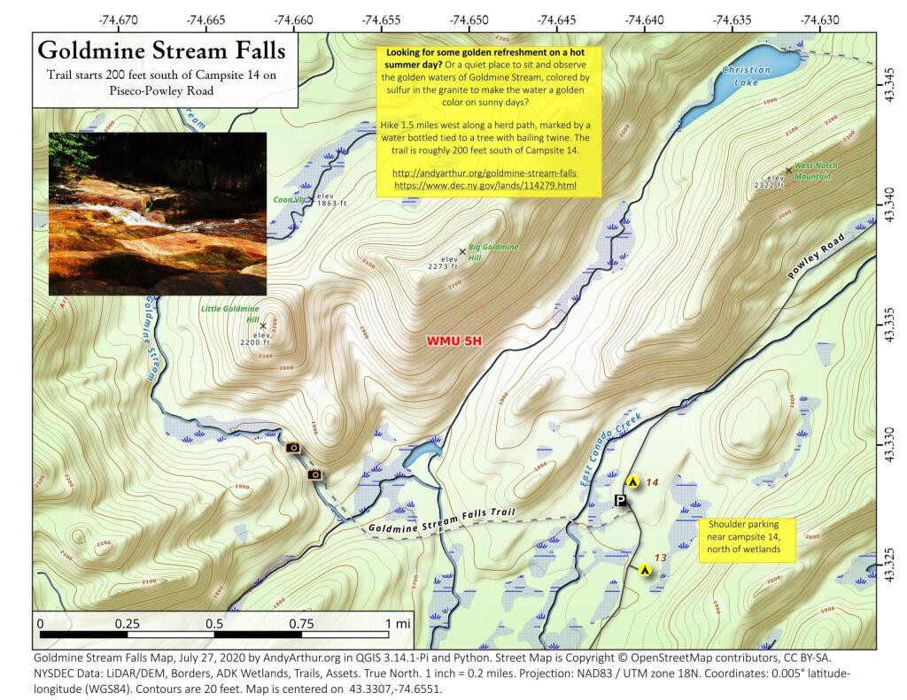
Looking for some golden refreshment on a hot summer day? Or a quiet place to sit and observe the golden waters of Goldmine Stream, colored by sulfur in the granite to make the water a golden color on sunny days?

Hike 1.5 miles west along a herd path, marked by a water bottled tied to a tree with bailing twine. The trail is roughly 200 feet south of Campsite 14.

http://andyarthur.org/goldmine-stream-falls

https://www.dec.ny.gov/lands/114279.html
Goldmine Stream Falls

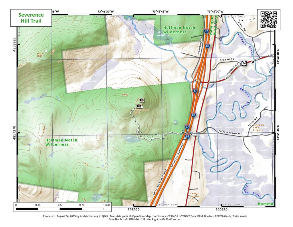
Map: Severence Hill Trail

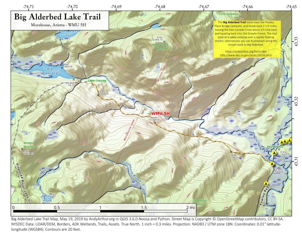
Big Alderbed Lake Trail

There is an old snowmobile trail/woods road by the Powley Place Bridge, that extends 2.5 miles west to Big Alderbed, that takes you to a wire crossing over the East Branch. The trail follows the East Branch for a short distance, then heads back into an interesting Old Growth Forest with a lot of big trails. To reach Big Alderbed -- which is largely drained wetland due to a failed dam -- you have to bushwhack along the stream to the mouth of the wetland.

 Big Alderbed Lake Trail

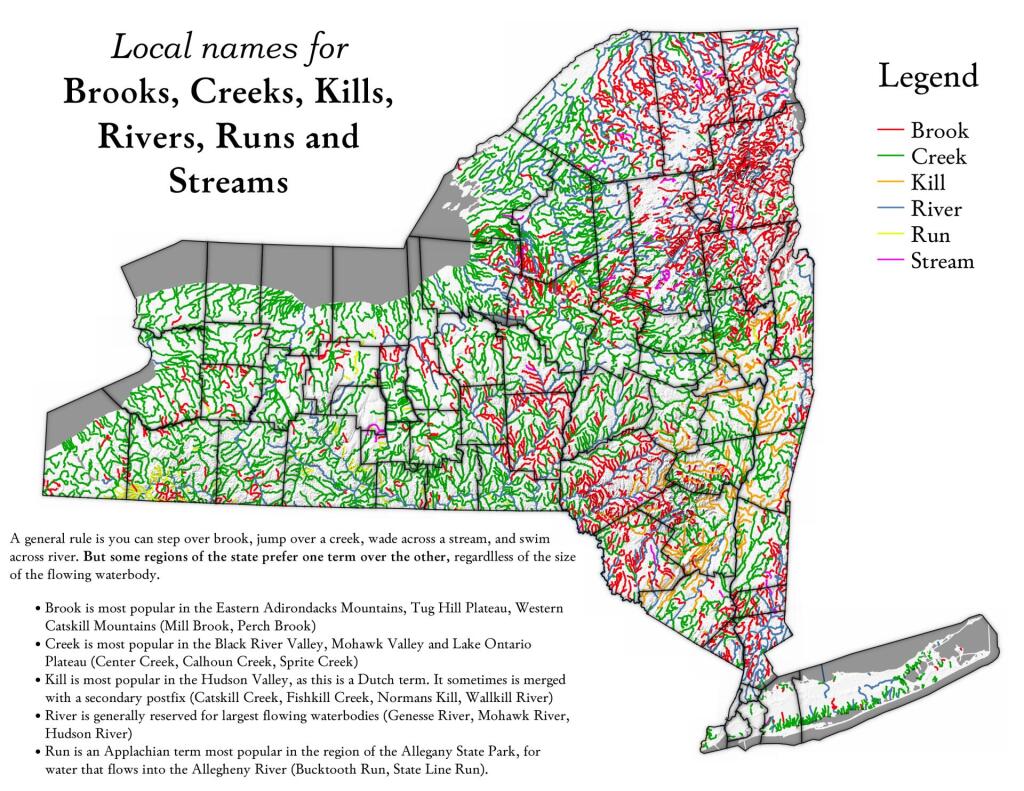
Map: Local Names for Brooks, Creeks, Kills, Rivers, Runs and Streams
Thematic Map: Major State Touring Routes
Map: Severence Hill Trail

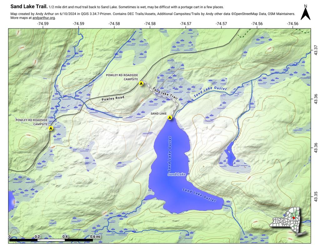
Sand Lake

Sand Lake is a 1/3rd of a mile away from Piseco Powley Road. The trail is somewhat overgrown and marshy, so a paddle cart won't work for well for carrying a boat back here, but with another person you should be able to get back here.

 Sand Lake

3D Map: Spencer Crest Nature Center