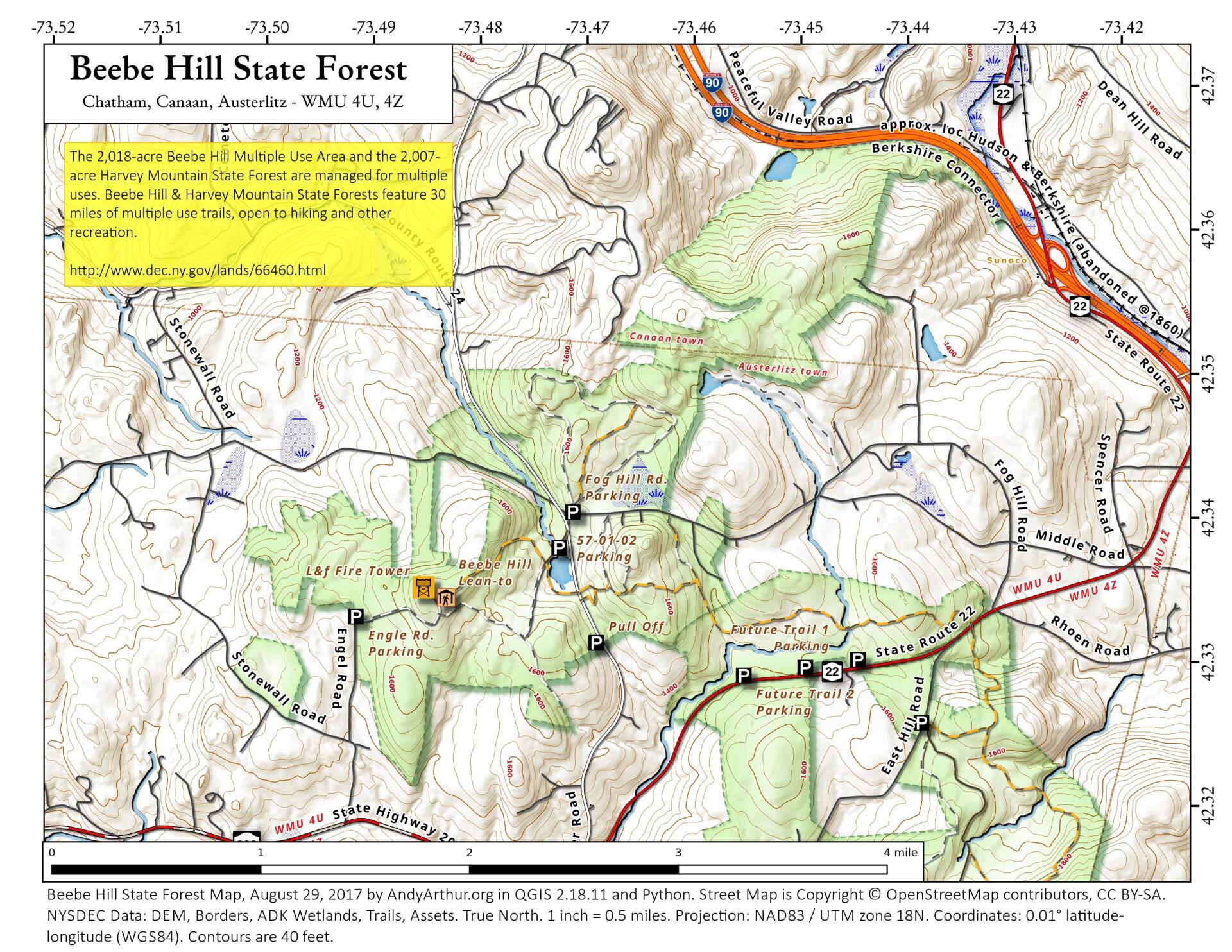
Beebe Hill State Forest

Download a High Resolution JPEG Image of the Beebe Hill State Forest or an Adobe Acrobat Printable PDF of the Beebe Hill State Forest.

Bookmark my free Interactive GPS Map for your phone:
https://andyarthur.org/ny
... shows your location as a blue dot in relationship to campsites, trails, state land. This online map requires cell service, won't work in remote country, so also bring a paper map.
Free Download of New & Historical USGS 1:24k Topograpic Maps
Interactive maps with backcountry and roadside camping: New York, Pennsylvania, West Virginia & Vermont. List of NYS DEC Lean-Tos and Firetowers.
Google Spreadsheet with Roadside, Primitive and Pay Campsites
More about Beebe Hill State Forest...
Beebe Hill State Forest (in the Columbia County town of Austerlitz) was established in 1963 and is the home of the Beebe Hill fire tower, erected in 1964 and operated through 1987. Recent history has seen the protection of over 3,000 acres of state forests in Columbia County. The 60-foot-tall fire tower was originally constructed on Alander Mountain in the Berkshires in 1928. Five years later it was moved to Washburn Mountain in Columbia County, where it stood until it was moved to Beebe Hill in 1964. Harvey Mountain State Forest, to the east, was purchased in 1999 and adjoins Beebe Hill State Forest.
http://www.dec.ny.gov/lands/66460.html


No Comments
Thanks for this useful map. I am interested in finding a map that shows the individual forest stands within the Beebe Hill state forest. Do you know where I could find this information?
Thanks.
I put together a map of this from the DEC data: https://andyarthur.org/terrain-map-primary-tree-type-beebe-hill-and-harvey-mountain.html
2 Trackbacks and Pingbacks