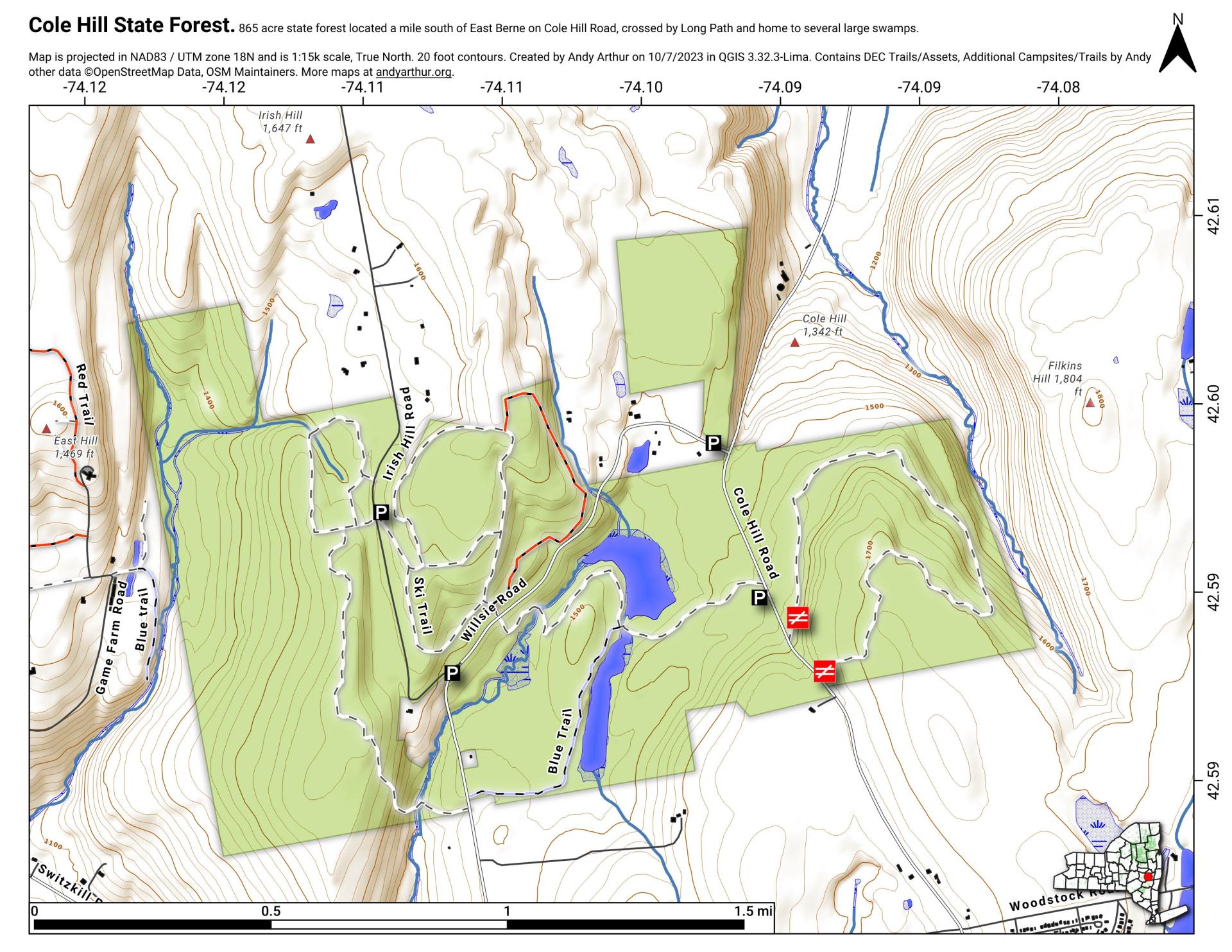
Cole Hill State Forest

Download a High Resolution JPEG Image of the Cole Hill State Forest or an Adobe Acrobat Printable PDF of the Cole Hill State Forest.

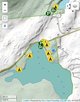
Bookmark my free Interactive GPS Map for your phone:
https://andyarthur.org/ny
... shows your location as a blue dot in relationship to campsites, trails, state land. This online map requires cell service, won't work in remote country, so also bring a paper map.
Free Download of New & Historical USGS 1:24k Topograpic Maps
Interactive maps with backcountry and roadside camping: New York, Pennsylvania, West Virginia & Vermont. List of NYS DEC Lean-Tos and Firetowers.
Google Spreadsheet with Roadside, Primitive and Pay Campsites
More about Cole Hill State Forest...
The 876-acre Cole Hill State Forest is located in the town of Berne in Albany County. Cole Hill and much of the surrounding areas were made up of the Van Rensselaer manor called Rensselaerwyck. Much of the estate was broken up in the early 19th century after tenants were tired of paying perpetual leases, leading to the Anti-Rent War. Cole Hill State Forest is managed by the multiple-use concept. Foresters plan complementary uses such as habitat diversity, recreation, water, wildlife, wood products and natural beauty so as to promote a healthy and useful forest. Recreational opportunities include hiking, snowmobiling, cross-country skiing, hunting, fishing, trapping and wildlife viewing.
http://www.dec.ny.gov/lands/66375.html


