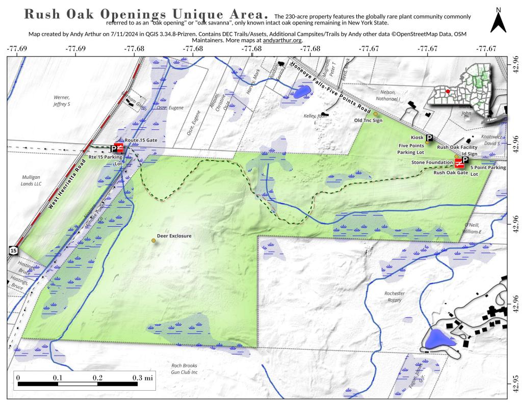
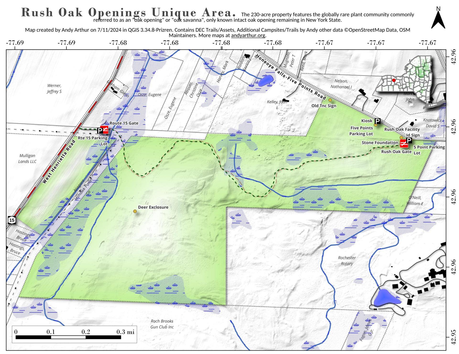
Rush Oak Openings Unique Area
Download a High Resolution JPEG Image of the Rush Oak Openings Unique Area or an Adobe Acrobat Printable PDF of the Rush Oak Openings Unique Area.

Bookmark my free Interactive GPS Map for your phone:
https://andyarthur.org/ny
... shows your location as a blue dot in relationship to campsites, trails, state land. This online map requires cell service, won't work in remote country, so also bring a paper map.
Free Download of New & Historical USGS 1:24k Topograpic Maps
Interactive maps with backcountry and roadside camping: New York, Pennsylvania, West Virginia & Vermont. List of NYS DEC Lean-Tos and Firetowers.
Google Spreadsheet with Roadside, Primitive and Pay Campsites
More about Monroe County...
Monroe County, situated in western New York, encompasses a diverse blend of urban and suburban landscapes, offering a dynamic environment for residents and visitors alike. Anchored by the city of Rochester, the county boasts a rich cultural scene, educational institutions, and a strong economy. The county's suburban areas provide a balance between city amenities and a quieter lifestyle. Outdoor enthusiasts can explore the shores of Lake Ontario, numerous parks, and the historic Erie Canal. Monroe County's thriving arts and entertainment scene includes theaters, museums, and festivals. With a mix of urban vibrancy and natural beauty, Monroe County offers a wide array of experiences, from bustling city life to outdoor adventures, making it a region that caters to a diverse range of interests.


