Wakely Mountain Trail
Download a High Resolution JPEG Image of the Wakely Mountain Trail or an Adobe Acrobat Printable PDF of the Wakely Mountain Trail.

Bookmark my free Interactive GPS Map for your phone:
https://andyarthur.org/ny
... shows your location as a blue dot in relationship to campsites, trails, state land. This online map requires cell service, won't work in remote country, so also bring a paper map.
Free Download of New & Historical USGS 1:24k Topograpic Maps
Interactive maps with backcountry and roadside camping: New York, Pennsylvania, West Virginia & Vermont. List of NYS DEC Lean-Tos and Firetowers.
Google Spreadsheet with Roadside, Primitive and Pay Campsites
More about Wakely Mountain...
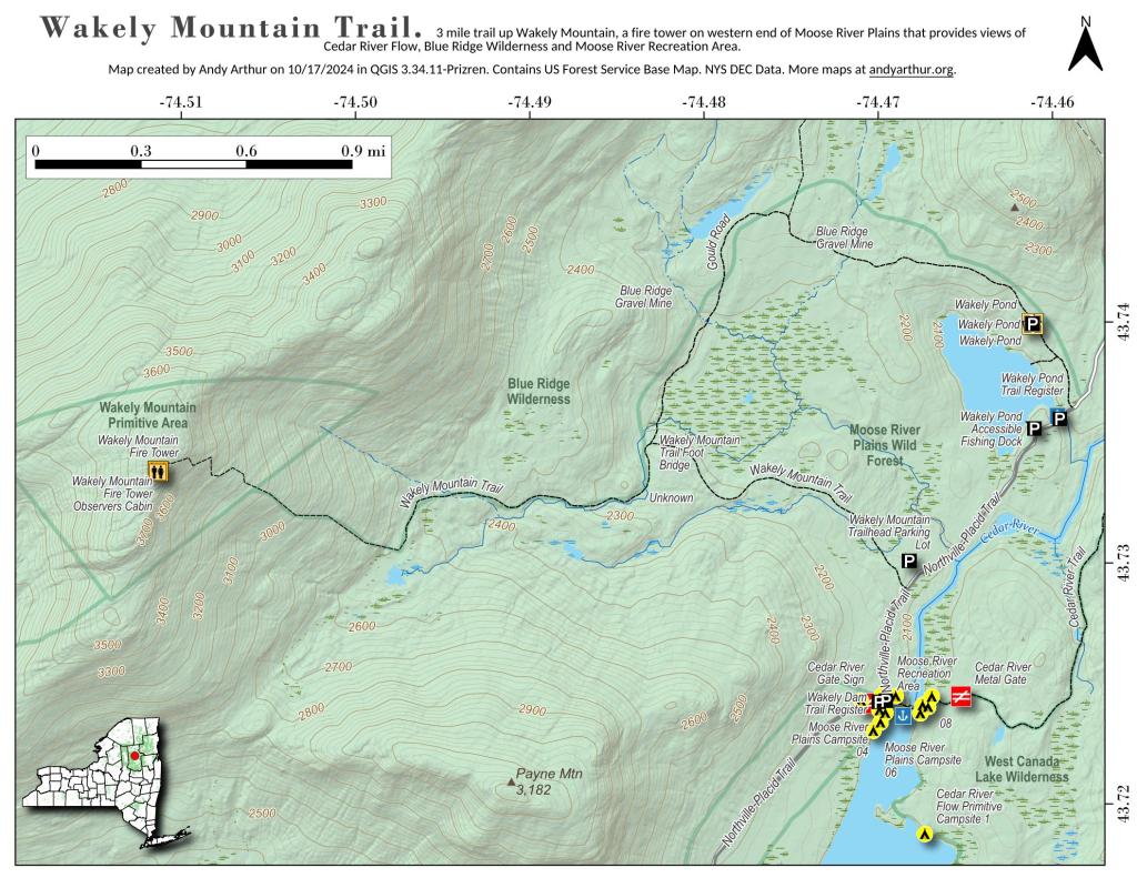
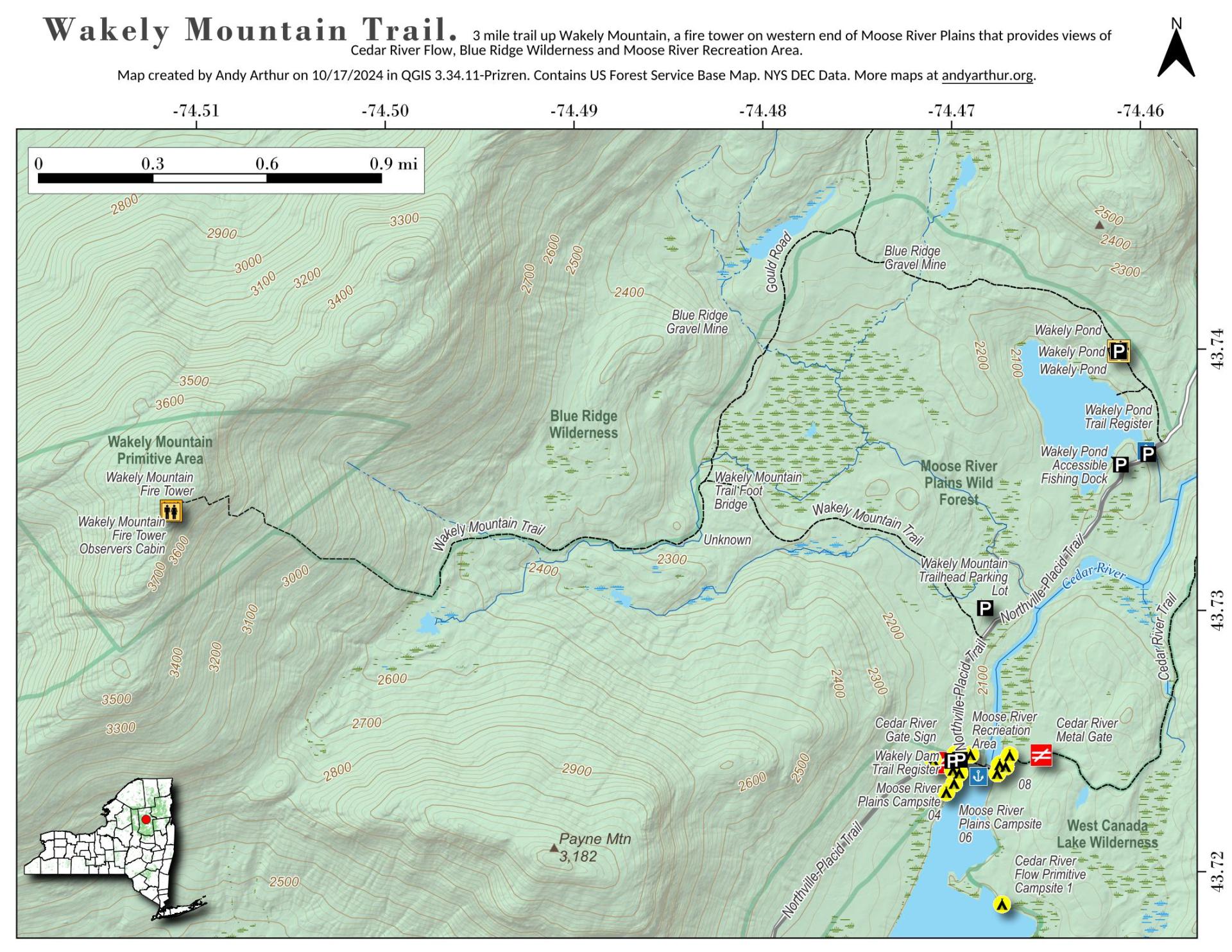
Wakely Mountain Firetower is a 92-foot tall firetower, the tallest in New York State, and is located at 3,742 ft elevation mountain. It offers views of the Blue Ridge Wilderness, High Peaks, Fulton Chain of Lakes, Payne Mountain, Cedar River Flow (southern end), Moose River Plains, and West Canada Lake Wilderness.
It is a 3.0 mile hike up it, with a 1635 ft ascent. The first 2 miles follow a gently climbing old woods road, with the last 1.0 miles being a 1,300 ft ascent.
The trailhead is located 1 mile east of Wakely Dam / Cedar River Entrance of Moose River Plains or 12 miles west of the Cedar River Road and NY 30 triangle.
Download the PDF Map Pack with All Maps from Wakely Mountain.


