Indian Lake
Download a High Resolution JPEG Image of the Indian Lake or an Adobe Acrobat Printable PDF of the Indian Lake.
About Map: Indian Lake ....
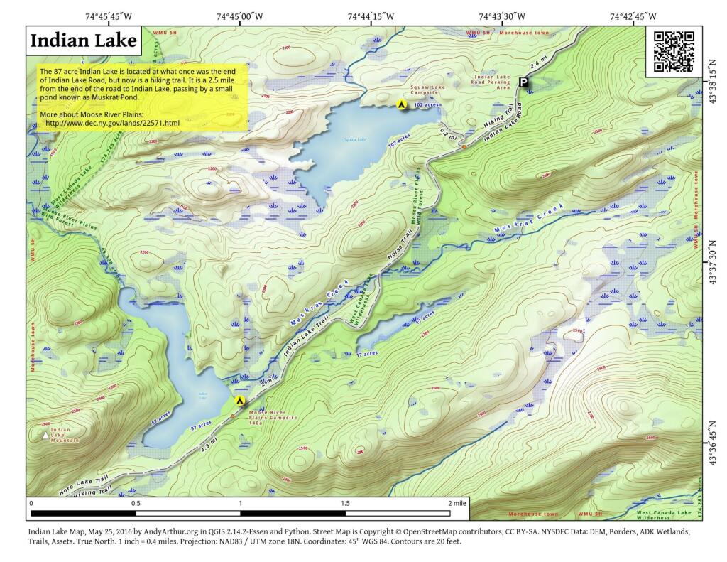
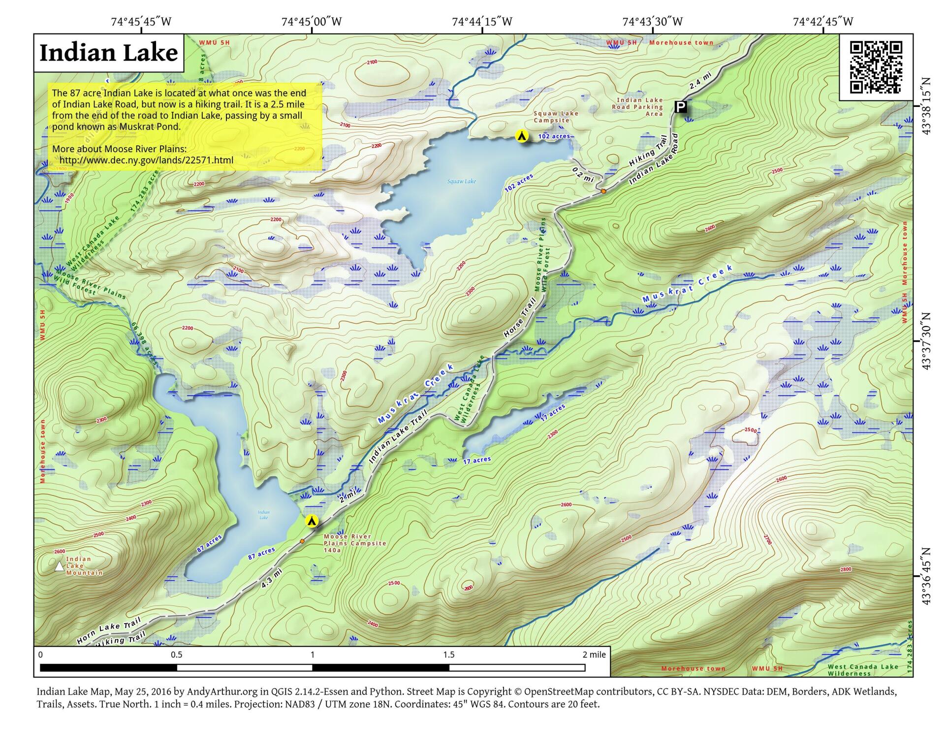
This map shows the Indian Lake Trail from Squaw Lake, past Muskrat Lake to Indian Lake at Moose River Plains. The old Indian Lake Road terminates about a 1/4 mile before Squaw Lake pursuant to a compromised implemented under the demands of the wilderness activists.

Bookmark my free Interactive GPS Map for your phone:
https://andyarthur.org/ny
... shows your location as a blue dot in relationship to campsites, trails, state land. This online map requires cell service, won't work in remote country, so also bring a paper map.
Free Download of New & Historical USGS 1:24k Topograpic Maps
Interactive maps with backcountry and roadside camping: New York, Pennsylvania, West Virginia & Vermont. List of NYS DEC Lean-Tos and Firetowers.
Google Spreadsheet with Roadside, Primitive and Pay Campsites
More about Indian Lake...
Indian Lake (82 acres) is located at the end of the recently closed Indian Lake Road. It's now a 2.5 mile hike back to lake, due to the road closure.
It was a productive fishery that became fishless due to acid deposition. The lake is becoming less acidic in recent years, but still has trouble sustaining fish, with a ph of 5.3.


