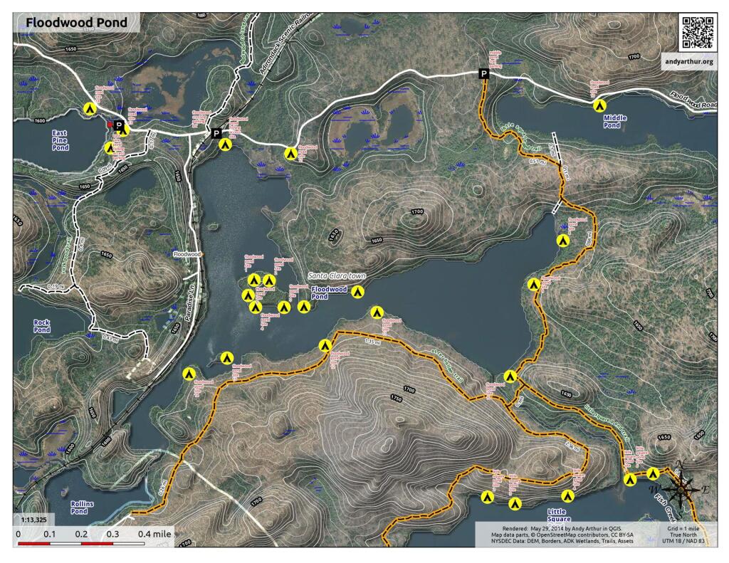
Floodwood Pond
Download a High Resolution JPEG Image of the Floodwood Pond or an Adobe Acrobat Printable PDF of the Floodwood Pond.

Bookmark my free Interactive GPS Map for your phone:
https://andyarthur.org/ny
... shows your location as a blue dot in relationship to campsites, trails, state land. This online map requires cell service, won't work in remote country, so also bring a paper map.
Free Download of New & Historical USGS 1:24k Topograpic Maps
Interactive maps with backcountry and roadside camping: New York, Pennsylvania, West Virginia & Vermont. List of NYS DEC Lean-Tos and Firetowers.
Google Spreadsheet with Roadside, Primitive and Pay Campsites
More about Floodwood Pond Loop...
One of the most popular route in Fish Creek Ponds in Saranac Wild Forest is the Floodwood Loop.
Drive to the put-in along the Floodwood Road from Saranac Inn off Route 30. Park up by the railroad tracks, and carry boats down to the pond, a short carry of about 75 yards from the parking area. At the take-out point, you can back your vehicle into the water. Paddling is essentially flatwater, with gentle river currents in the river stretches. This is an easy paddle-trip of about five miles or 3 hours, suitable for paddlers of all ages and abilities. Trip can be extended into multiday, looping trips quite easily, as the area is almost as much water as land.


No Comments
Thx…….have a wee lassie 12 Wenona pak canoe……..am 85…….would like some easy camping in the flood wood pond area……..is a very slow pace doable……….wife and I are still physically active…….how are the portages……we are minimalists……..both Outwardbound graduates 30 years ago……
They aren’t terrible, many are only a few hundred feet and often are well worn, some scrambles over banks!