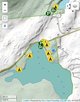
Town of Amherst, NY Hamlets and Villages

Download a High Resolution JPEG Image of the Town of Amherst, NY Hamlets and Villages [Expires June 12 2026] or an Adobe Acrobat Printable PDF of the Town of Amherst, NY Hamlets and Villages [Expires June 12 2026].
![High Resolution JPEG Image of the Town of Amherst, NY Hamlets and Villages [Expires June 12 2026]](/data/photo_023707_c.jpg)

Bookmark my free Interactive GPS Map for your phone:
https://andyarthur.org/ny
... shows your location as a blue dot in relationship to campsites, trails, state land. This online map requires cell service, won't work in remote country, so also bring a paper map.
Free Download of New & Historical USGS 1:24k Topograpic Maps
Interactive maps with backcountry and roadside camping: New York, Pennsylvania, West Virginia & Vermont. List of NYS DEC Lean-Tos and Firetowers.
Google Spreadsheet with Roadside, Primitive and Pay Campsites
More about Erie County, NY...
Erie County is a highly populated county located along the shore of Lake Erie in western New York State. As of the 2010 census, the population was 919,040. The county seat is Buffalo, which makes up about 28% of the county's population.


![Thematic Map: 2024 Presidetnial Election - Erie County NY - Dot Density Map [Expires November 5 2026]](/data/photo_16401_small.jpg "Thematic Map: 2024 Presidetnial Election - Erie County NY - Dot Density Map [Expires November 5 2026]")


 vs. Chrissy Casilio (REP CON) vs. Duane J. Whitmer (LIB)")

