Three Corners LIDAR in Rensselaerville State Forest 🗺️

Download a High Resolution JPEG Image of the Terrain Three Corners LIDAR in Rensselaerville State Forest or an Adobe Acrobat Printable PDF of the Terrain Three Corners LIDAR in Rensselaerville State Forest.
About Three Corners LIDAR in Rensselaerville State Forest ....
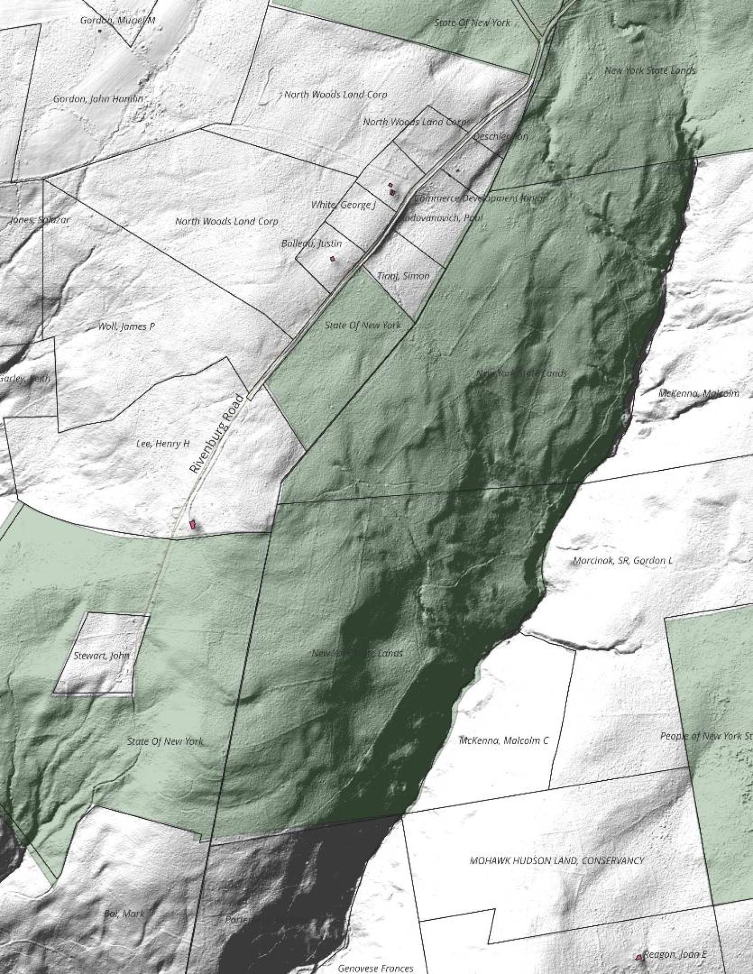
The other day when I was hiking back there I happened to open up my Campsite and Trail locator and accidentially scrolled into far and saw the LIDAR hillshade, showing several old woods roads that aren't on any map I have. I poked around on some of them and made this map up to share.

More about Rensselearville State Forest...
A well-kept secret in the western part of Rensselaerville. Minimal signage, best approached on Cheese Hill Road from County Route 358 or State Route 145 (Preston Hollow), or from Gulf Road off County Route 353. The area has several hilly, narrow seasonal roads--not for the faint of heart. The multi-use trails aren't blazed but are indicated by "Motor Vehicle Trail" signs. Recreation in this beautiful forest includes hunting, trapping, fishing, hiking, cross-country skiing, snowmobiling, mountain biking, nature observation, and birdwatching.
http://www.hilltowns.org/rensselaerville-state-forest.html
Download the PDF Map Pack with All Maps from Rensselearville State Forest.


