Cayuga Shores Wildlife Management Area
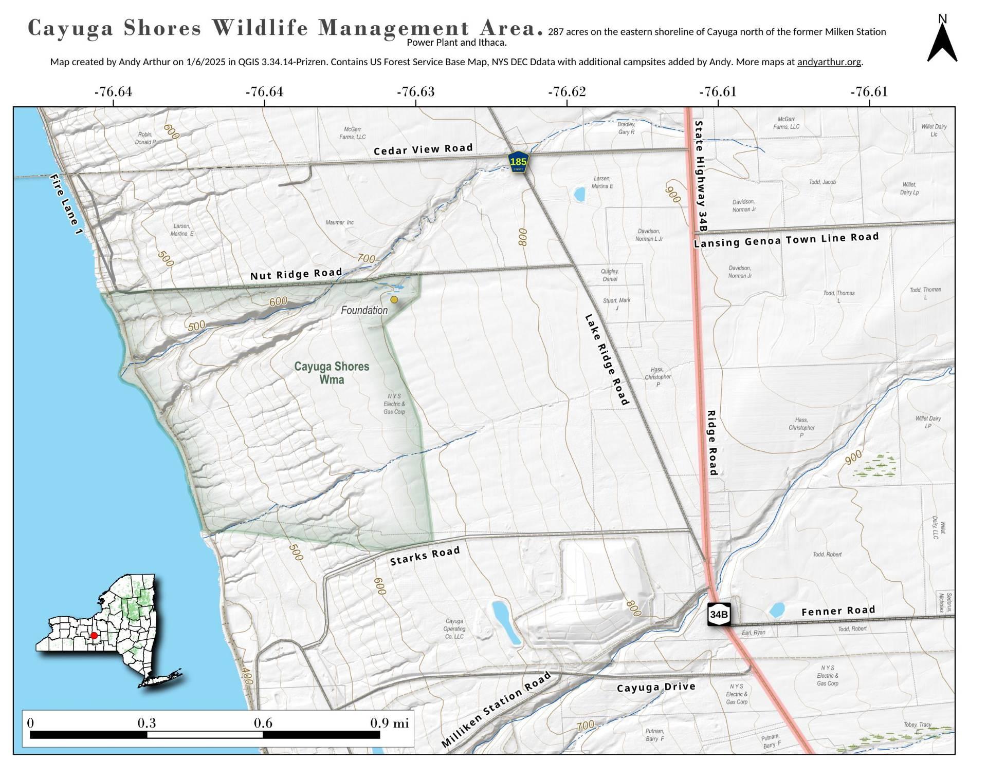
Download a High Resolution JPEG Image of the Cayuga Shores Wildlife Management Area or an Adobe Acrobat Printable PDF of the Cayuga Shores Wildlife Management Area.
About Map: Cayuga Shores Wildlife Management Area ....
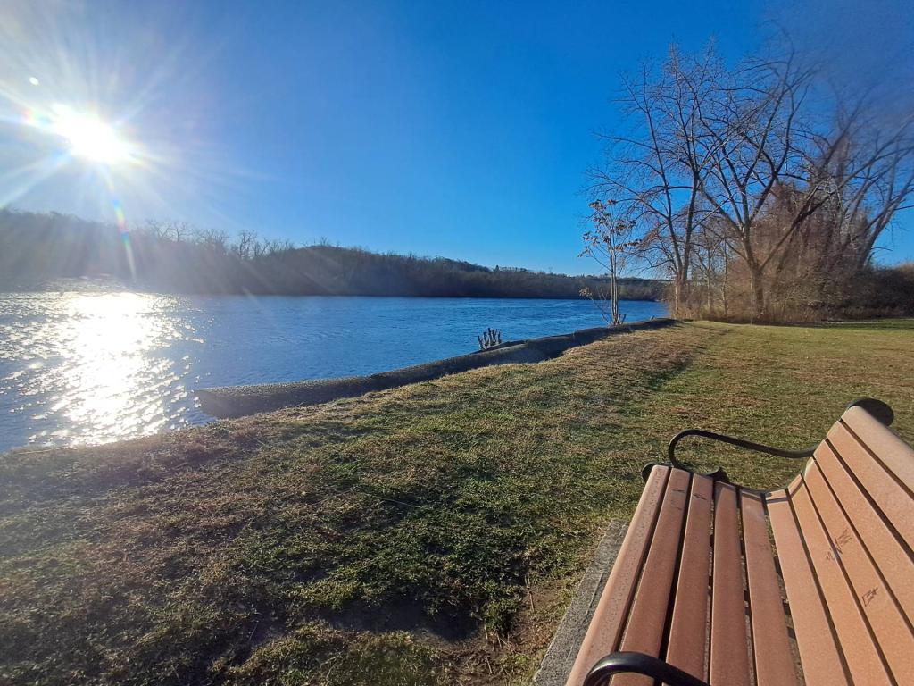
Cayuga Shores Wildlife Management Area is Located along the eastern shore of Cayuga Lake, this WMA provides public access to 287 acres of land and over 3,500 feet of undeveloped shoreline

Bookmark my free Interactive GPS Map for your phone:
https://andyarthur.org/ny
... shows your location as a blue dot in relationship to campsites, trails, state land. This online map requires cell service, won't work in remote country, so also bring a paper map.
Free Download of New & Historical USGS 1:24k Topograpic Maps
Interactive maps with backcountry and roadside camping: New York, Pennsylvania, West Virginia & Vermont. List of NYS DEC Lean-Tos and Firetowers.
Google Spreadsheet with Roadside, Primitive and Pay Campsites
More about Tompkins County...
Tompkins County is a county located in the U.S. state of New York, and comprises the whole of the Ithaca metropolitan area. As of the 2010 census, the population was 101,564. The county seat is Ithaca, and the county is home to Cornell University, Ithaca College and Tompkins Cortland Community College.
Tompkins County is in the west central part of New York State, south of Syracuse and northwest of Binghamton. It is usually geographically grouped with the Finger Lakes region, but some locals consider themselves to be part of Central New York or the Southern Tier.
http://en.wikipedia.org/wiki/Tompkins_County,_New_York

