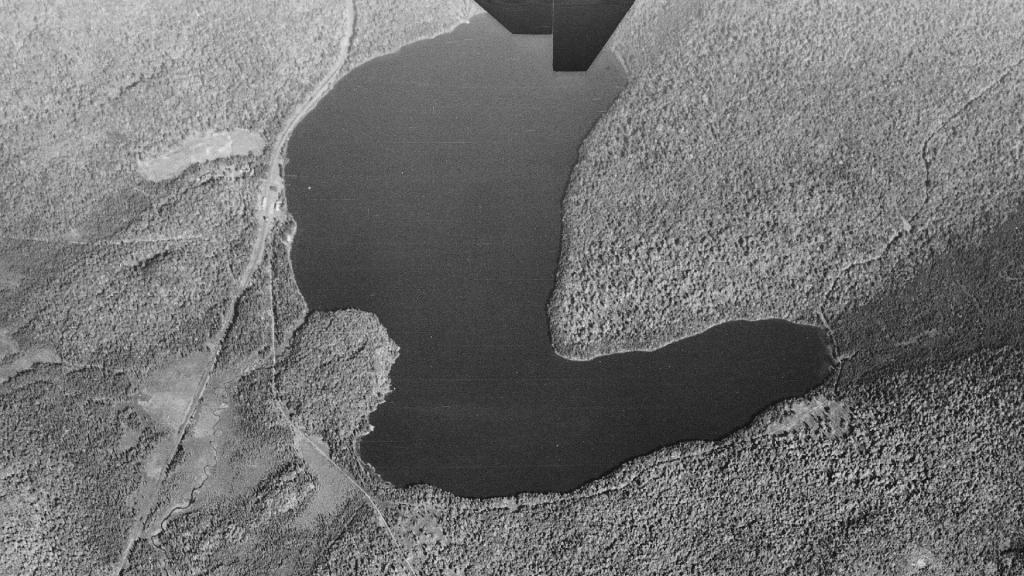
Horseshoe Lake October 2, 1942
I was curious how much of the original hamlet of Horseshoe was left when the World War II was starting. Some of it, but not a lot of it.
Tuesday October 21, 2025 — Horseshoe Lake — Horseshoe Lake 🗺

I was curious how much of the original hamlet of Horseshoe was left when the World War II was starting. Some of it, but not a lot of it.
Tuesday October 21, 2025 — Horseshoe Lake — Horseshoe Lake 🗺
The Sabattis Scout Reservation permanently closed as an active Boy Scout camp in late 2024 due to declining membership. However, the 1,525-acre wilderness property has been acquired by the Open Space Institute (OSI) for $2 million to preserve its pristine landscape. It borders the Five Ponds Wilderness Area and Lows Lake.
Operated by the Scouting America Longhouse Council from the 1970s until its 2024 closure. It is currently closed to the public under temporary OSI management. OSI plans to transfer the land to the New York State Department of Environmental Conservation (DEC). Once finalized, it will merge into the Adirondack Forest Preserve as a public gateway for hiking, fishing, and paddling along Lows Lake.
![Untitled [Expires August 12 2025]](https://mail.andyarthur.org//data/photo_007255_large.jpg)