New York State 📍

New York is a state in the Northeastern region of the United States. New York is the 27th-most extensive, the 3rd-most populous, and the 7th-most densely populated of the 50 United States. New York is bordered by New Jersey and Pennsylvania to the south, and by Connecticut, Massachusetts and Vermont to the east. The state has a maritime border with Rhode Island east of Long Island, as well as an international border with the Canadian provinces of Ontario to the west and north, and Quebec to the north. The state of New York is often referred to as New York State to distinguish it from New York City.

Download the PDF Map Pack
🗺️ Maps 🖼️ Photos 📽️ Videos

New York Route 421

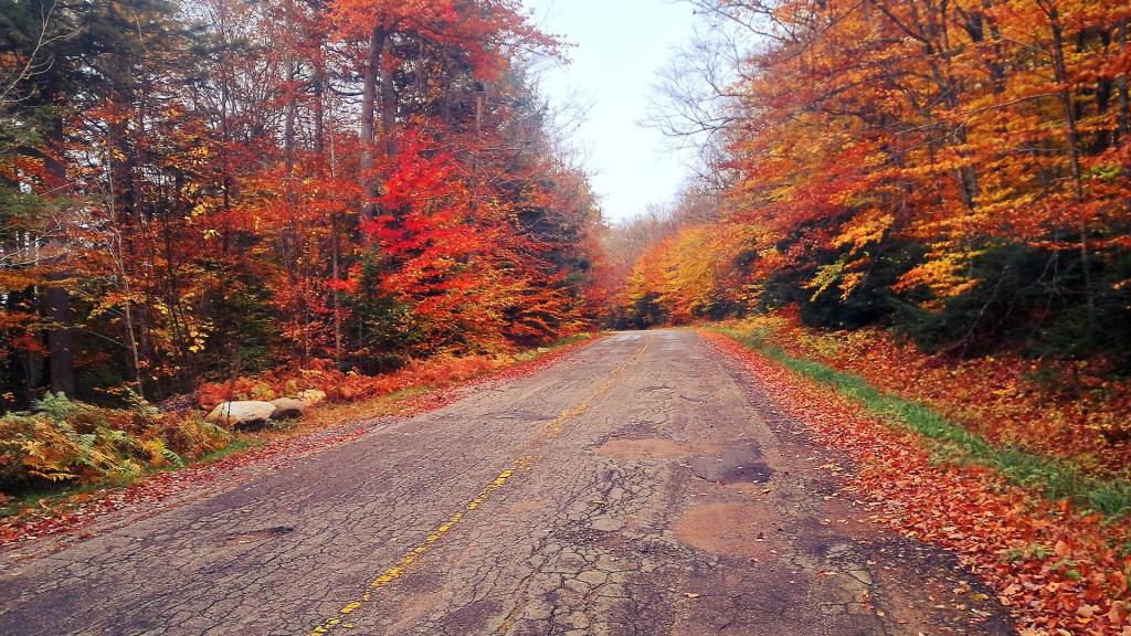
NY Route 421 is widely known for its rough and uneven condition, particularly the stretch that leads toward Horseshoe Lake in the Adirondacks. This is primarily caused by recurring frost heaves during the winter months, which buckle and crack the road surface. 
Tuesday October 14, 2025 — Horseshoe Lake Wild Forest — Bridgebrook Pond Trail 🗺 — Coney Mountain Trail 🗺 — Goodman Mountain Trail 🗺 — Lows Ledge Trail 🗺 — Otter Brook Road at Horseshoe Lake Wild Forest 🗺 — Winding Falls Trail - Bog River Ski Trail - Bog River Falls 🗺— PDF with All Maps 📚
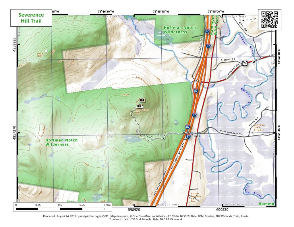
Map: Severence Hill Trail

Huntersfield Mountain

Interactive 3D Map of Huntersfield Mountain from Jim Clevelan Road to the summit where a lean-to is located.

Display Full Screen - Control + Mouse to Pan, SHIFT and +/- to zoom, arrow keys pan around MapLibre GL map.

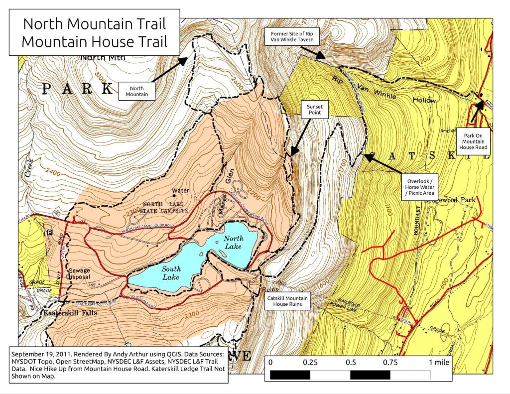
Map: Mountain House Trail and North Mountain

Sabattis Scout Reservation

The Sabattis Scout Reservation permanently closed as an active Boy Scout camp in late 2024 due to declining membership. However, the 1,525-acre wilderness property has been acquired by the Open Space Institute (OSI) for $2 million to preserve its pristine landscape. It borders the Five Ponds Wilderness Area and Lows Lake.

Operated by the Scouting America Longhouse Council from the 1970s until its 2024 closure. It is currently closed to the public under temporary OSI management. OSI plans to transfer the land to the New York State Department of Environmental Conservation (DEC). Once finalized, it will merge into the Adirondack Forest Preserve as a public gateway for hiking, fishing, and paddling along Lows Lake.

Display Full Screen - Control + Mouse to Pan, SHIFT and +/- to zoom, arrow keys pan around MapLibre GL map.

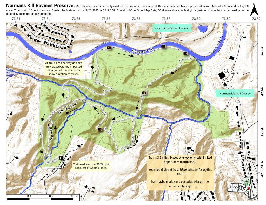
Map: Normans Kill Ravines Preserve